Our Services
Land & Right-of-Way
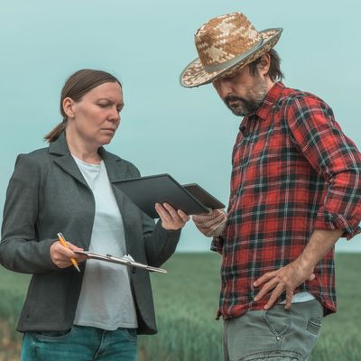
Field Worx group of land & right-of-way professionals are dedicated to protecting your existing infrastructure, as well as your capital improvement projects, by adhering to the most stringent ethical and industry standards. Our leadership team and agents have decades of knowledge in all aspects of land & right-of-way, from project initiation to closeout; with experience in, oil, gas, and chemicals, mineral, electrical transmission & distribution, telecommunications, renewables, transportation, and infrastructure projects. Our use of technology, innovation, reporting and quality control, guarantee the success of your project. True to our core values of honesty and integrity, Field Worx is your trusted land & right-of-way provider, with a limitless list of traditional and customized solutions.
- Route & site selection
- Feasibility studies
- Due diligence
- Surface & mineral title examination
- Genealogy research
- Stakeholder engagement & Outreach
- Non-environmental permitting
- Construction support & outreach
- Compliance and litigation support
- Technical writing
- ROW, site, & mineral acquisition
- Project management
- Damage settlements
- Market analysis
- Survey permission & notice
- Eminent domain support
- Land Records management
- Document Scanning

GIS & CAD
Field Worx staff of Geographic Information System (GIS) professionals and Computer Aided Design (CAD) technicians have decades of experience providing a long list of solutions to our partners across a breadth of industries. From gathering legacy and meta data to incorporate into a customized GIS solution to generating alignment sheets, exhibit maps, and detailed engineering drawings; Field Worx has provided the expertise and accuracy required to meet and exceed our client’s requirements. We utilize the most current versions of ESRI, AutoCAD, and Bentley software suites and continuously provide the necessary training to keep our staff at the forefront of technology. We team with reputable survey, engineering, and aerial patrol firms to meet the specifications of your project.
- Custom Web Map Applications
- Asset Management
- Legacy Conversion
- Site Plans
- 3D Models
- Data Conversion
- Plan & Profile
- Alignment Sheets
- Exhibits
- Civil Drawings
- Mechanical Drawings
- Data Extracting
- Wall Maps
- Land Records management
- Document Scanning
- 3D Renderings
- Architectural Drawings
- Data Processing
Unmanned Aerial Vehicle (UAV)
Field Worx has a team of FAA licensed UAV pilots available for deployment on any project. We understand the need to monitor your site on a routine basis. Whether its traditional video imaging, infrared, or methane detection, our advanced UAV's are capable of assessing your infrastructure, timely and accurately.
- Videography
- Infrared
- Methane Detection